Updated Sat 15 Oct 2016 • tags maps, europe
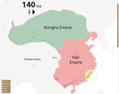
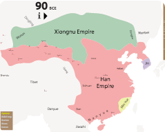
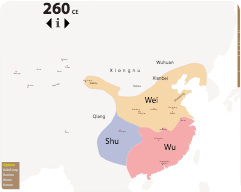
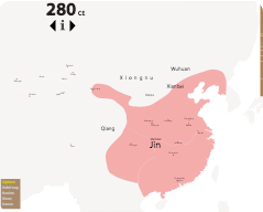
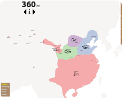
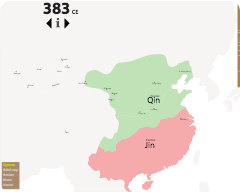
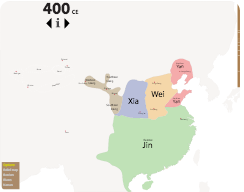
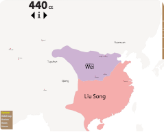
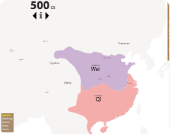
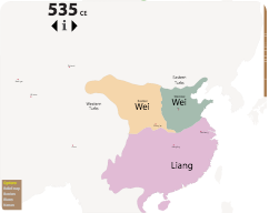
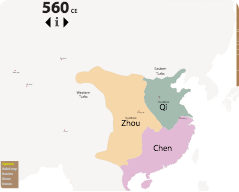
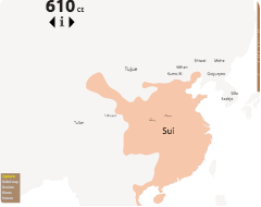
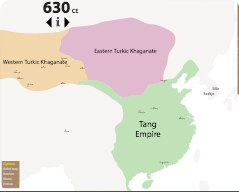
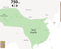
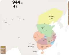
This is a collection of maps set against the same, unchanging background, so that when you switch from map to map you can see how boundaries evolve. These maps are about East Asia, and the initial set are largely focused on China.
There are options that bring things in and out of the map. These include: schematic vs. relief background; country and province borders vs. none, old vs. modern place names, old vs. modern city names, rivers vs none. Note, however, that the relief map comes with some borders and rivers already marked. Use the scroll wheel to zoom in and out, and hold the mouse down to move the map around.
Boundaries are approximate for a number of reasons: first, in the earlier times especially, the borders were only approximate anyway; second, I have usually deduced the boundary information from small-scale maps, and sometimes the lack of geographical features makes accuracy difficult; third, the sources often differ about where boundaries lay, or are tied to dates that are slightly different. You should therefore treat the boundaries on the maps as approximate. However, at this scale, and in order to provide an idea of key changes at the pan-Asian level, this is typically sufficient.
The background relief map is from Wikipedia. The rest is hand-drawn.